Here are a few nice walks that I’ve done on Søndre Sandøy in 2015 and 2018. Please tell us about your favourites in the comments section below if you know the island 🙂
Map of Søndre Sandøy here. Map of Hvaler here. Søndre is part of the longer Coastal Trail. See my separate post for a walk on neighbouring Herføl)..
Please click on the photo galleries below for a better view.
Walk 1:
The nicest, and most popular beach on the island is Stuevika, which for us is about thirty minutes walk from the other side of the island. There are in fact two beaches, one bigger one smaller, separated by a small rocky headland. The water is warm enough to swim in as its heated by the gulf stream from Mexico in the summer months. You can camp in this tranquil spot if you want to come and stay for a few days.


Just a slightly north along the shoreline from the second smaller beach Lille Stuevika is a great diving spot that I used to come to in my younger days. I have to do the jump again for old times sake every time I come.
The views across the fjord are fantastic from here. In the photos the land on the left across the water is the coastline of Sweden.


In the opposite direction, just slightly to the south of Stuevika is the ‘secret beach’, a little private cove. You’ll have to find it yourself though as I’m not telling!
Walk 2:
On another day in 2015 we went for a nature and archaeology walk with our Uncle Svein and Auntie Eva’s family. We did a loop starting near their house on Sanderødveien. Svein’s And Eva’s children are mine and Dan’s second cousins and we spent a lot of time together in the summer holidays when we were growing up. Our cousin Monika works in local conservation and she knows the island and its nature like the back of her hand, so she was pointing out unusual species to us everywhere we went.


We had several interesting features pointed out to us along the way. The whole of Norway was glaciated during the Ice Age and a few features can still be seen from this time. In this picture Svein is standing in a cylindrical pot hole called a Trollgryte (troll pot) that was bored out over time by melting water and rotating gravel and stones at the bottom of the glacier. This particular one, known as Hytte Gryte, is a very big one, they are usually much smaller.


Our cousin Lillian, also on the walk, is a local archaeologist and she took us to a couple of archaeological sites on the island that we had never known about before. These are the ancient walls of temporary shelters for Iron Age fisherman who would come to the island to catch and dry fish in the summer months.


To find it, walk along the path from Salta which runs south down the east side of Pølen bay. Walk past the boat quays until you can’t walk any further, then turn left and walk inland. You’ll come to the walls after just a few metres. Video here.
There’s also a Bronze Age cairn, a pile of rocks on a high outcrop of rock overlooking the water, locally known as Røysa. No one knows for sure whether it was a signalling post, a burial or whether it was just meant to demonstrate ownership of the island. I’m guessing the former as there is another cairn immediately opposite on the next island Herføl (see this post).

The views across the water to Herføl make it a great spot to stop for a picnic. Just below the hill at Rødsbrygge is the historic spot where in 1813, during the Napoleonic wars, King Christian Frederik of Norway and Denmark secretly stepped back onto Norwegian land in order to claim his throne.


Røysa is a little hard to find. You’ll find it on my map and here’s a video of the path.
Walk 3:
In 2018 my brother Dan and I walked to the small lighthouse on Reiertangen, a headland just to the north of Gjøkvika beach, on the east coast of the island. Most of the way we walked along the ‘heart’ route, one of several paths (named after the suits in packs of cards) that criss-cross the island, although you’ll have to find your own way for the last bit. Again it’s marked approximately on my map. Video here.


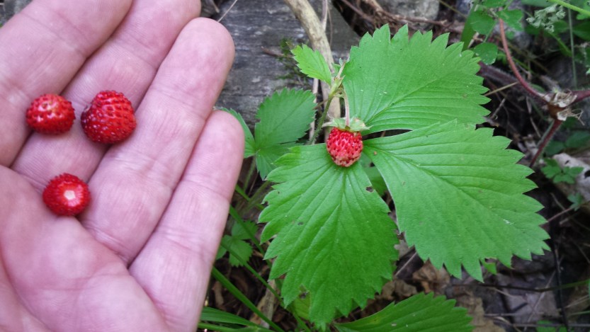
Wherever you walk, keep an eye out for wild berries along the way. As kids we’d thread wild strawberries like these on long stalks of grass, along with blueberries and cranberries, then pull the stalks through our mouths so we got a big glorious mouthful all at once!
So these are a few of our favourite walks on Søndre. What are yours? Feel free to reply in Norwegian or English, or any other language, in the comments below 🙂